history

Freedom Plaza Part I: Origins

This is Part I of a III Part series. Please join and support us on Patreon to read the the rest!
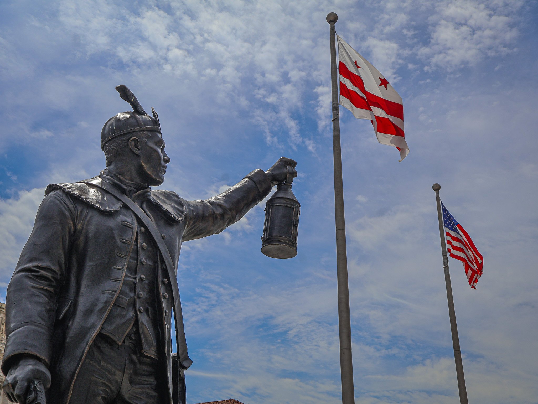
Statue of Jack Sisson. One of more than a dozen new statues added to Freedom Plaza over the past year.

Over the past calendar year downtown DC’s Freedom Plaza has been transformed and updated, with some changes permanent and others temporary. Reopening this summer after a long closure dating back to the early winter months, the plaza has seen the addition of a cadre of statues, updated quotations, and a renovated water fountain. In this series, I will explore the origins of Freedom Plaza, some of the key infrastructure changes, cover each of the new statues including who (or what) they commemorate, and how the meaning of Freedom Plaza has changed over the last 40 years.

Part I: Origins of Freedom Plaza

Freedom Plaza is the name of a rectangular, city block-sized park located just southeast of the White House and north of the National Mall area. The park is bounded by 13th Street, 14th Street, and a split Pennsylvania Ave on the north and south sides, although some maps still label the north side of Penn Ave as E Street. Across the southern edge of Freedom Plaza is the John A. Wilson Building, the home of DC's local municipal government. The Wilson Building has its own adjacent statues, Alexander Shepherd and Marion Barry.

Freedom Plaza dates back to 1980 and was originally named Western Plaza. In 1974 a new Congressionally established agency, the Pennsylvania Avenue Development Corporation (PADC), created a report to guide the next few decades of growth along the Avenue corridor. The PADC’s main goal was to revitalize the portion of the Avenue between the White House and the Capitol. In order to accomplish this goal, they set ambitious objectives including making Pennsylvania Avenue more attractive and practical for pedestrians, preserving existing historic structures on the Avenue and its side streets, and establishing new spaces for commercial, residential, and cultural venues. The PADC’s work spanned from basic projects like repaving the roadway and sidewalk landscaping all the way to establishing complex public-private partnerships with developers to create new buildings that aligned with PADC plans. 
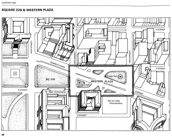
Illustration of the area around Western Plaza before it was consolidated into an actual park.
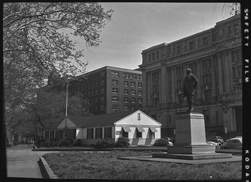
1952 pre-Western Plaza photo of the Veterans Information Center and Shepherd statue, in front of the District Building.

The proposal that resulted in the creation of Western Plaza leaned on the original L’Enfant plan of Washington, which included a plaza on this site. In the late 1970s, this area was bisected by car travel lanes of Pennsylvania Avenue (see illustration above). On each side of the thoroughfare were two smaller existing pocket parks, one of which already held a statue of General Casimir Pulaski (now in Freedom Plaza), and the other a statue of Alexander Shepherd (now at the Wilson Building).

One of the goals of Western Plaza was to better frame and present the District Building (now known as the John A. Wilson Building) from Pennsylvania Ave, as well as any future buildings on the land next to the District Building. Those lots ended up becoming the massive Ronald Reagan Building and International Trade Center. The design of Western Plaza is credited to the firm Venturi, Rauch & Scott Brown with additional contributions from George E. Patton.
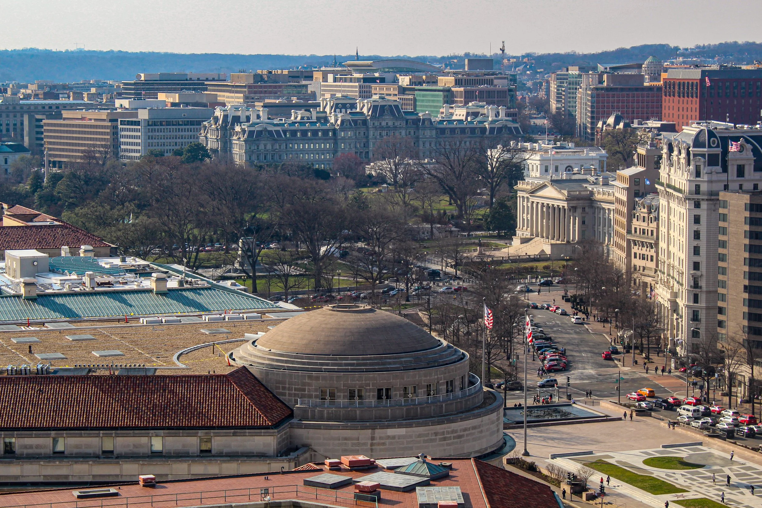
Freedom Plaza (lower right) is one block from the U.S. Treasury and the White House. The domed Trade Center building is seen at center.

The plaza was planned to be a place for workers or visitors to escape the busy city sidewalks, despite much of the plaza being an open stone plinth with little tree cover or seating. The main artistic element is an oversized blueprint style, 1887-era map of the L’Enfant plan, specifically the part of the city linking the White House to the U.S. Capitol. Early plans included three dimensional models of the White House and Capitol Building to be placed on the plaza, but those were ultimately scrapped. What did make it into the plaza were multiple historic quotations that are incised across the Plaza’s floor. Quotes range from selections from the Constitution, to literary giants, presidents, civil rights leaders, and others from the first 200 years of American history. Once completed in 1980, the plaza remained essentially static over the past 40 years, except for one big change.

In 1988 the name of Western Plaza was changed to Freedom Plaza to honor Dr. Martin Luther King, Jr. 1988 marked 20 years since the assassination of Dr. King and 5 years since his birthday became a federal holiday. King also stayed at the adjacent Willard Hotel before the March on Washington in 1963. To mark the plaza’s name change, a time capsule was placed under the plaza, set to be opened in 100 years time (2088), when we are set to reflect on Dr. King's legacy more than a century after the Civil Rights Movement. The capsule contains one of King’s bibles, a clerical robe, cassette tapes of a number of his speeches, and a special U.S. flag with 51 stars, a nod to potential statehood status for Washington, DC. Dr. King supported local control for the residents of DC, and a version of home rule was passed into law after his death, in 1973. More than a decade later, Congress authorized the King time capsule by Joint Resolution in 1987.
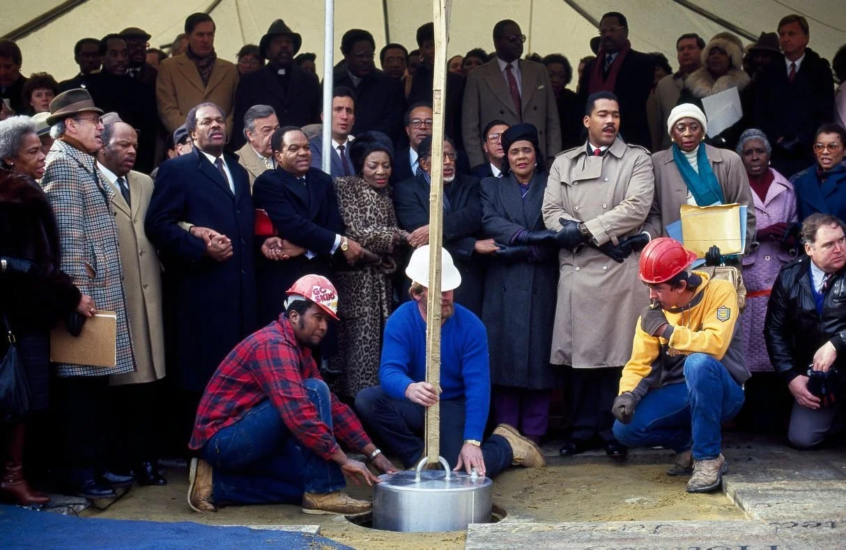
Coretta Scott King and others gather to dedicate Dr. King's time capsule in 1988.
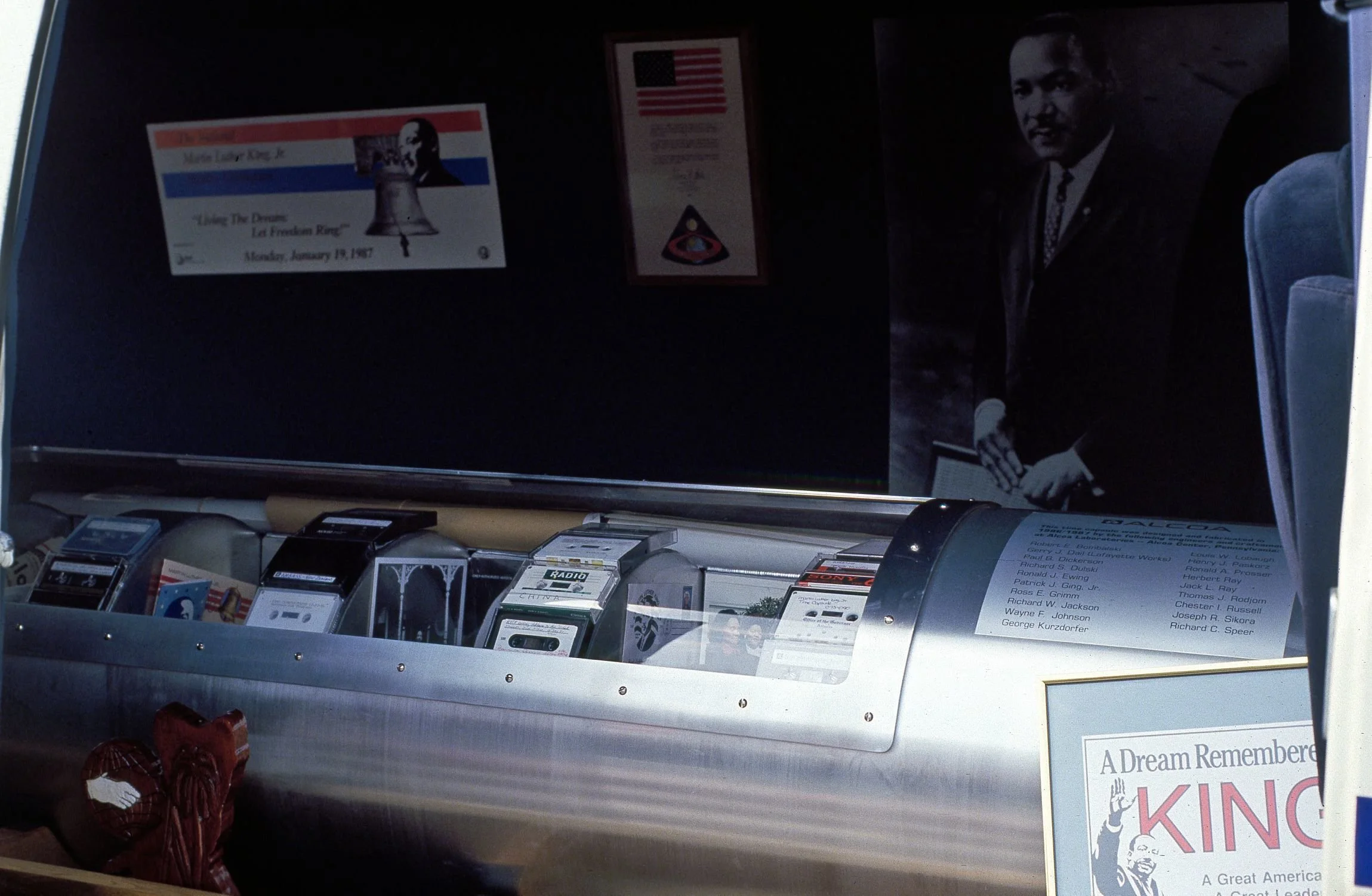
The time capsule before being lowered into the ground.

Since 1980 Freedom Plaza has indeed been a public commons of sorts, acting as a flex space for all types of gatherings. It’s been the home base of protest marches and demonstrations, a stage for musical performances, home to the annual celebration of Emancipation Day in DC, the start & end point to many road races and marathons, witness to every Presidential Inaugural parade since 1980, the location of temporary outdoor exhibitions, and as a transitional space between the National Mall and the commercial area of downtown DC.
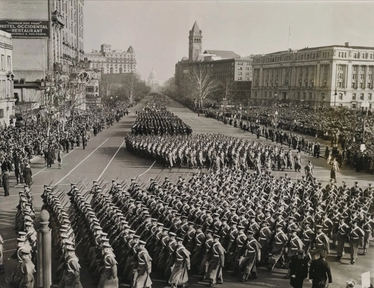
Parade for Franklin Roosevelt's third Presidential Inauguration in 1941. This area became Western Plaza 40 years later.

By 2020, the vision for Freedom Plaza and Pennsylvania Avenue established by the PADC had run its course. The National Capital Planning Commission is currently operating under a new plan with a similar name, the Pennsylvania Avenue Initiative

Aside from the greater Pennsylvania Avenue Initiative, over the course of this year, the Plaza has been transformed in accordance with the larger acknowledgments of the 250th anniversary of the Declaration of Independence. A number of statues have been added to the park, ostensibly by the Department of the Interior and the National Park Service. Including a statue of the allegorical Spirit of Liberty, more than a dozen new statues have been added to Freedom Plaza in 2026, all representing men from the era of the American Revolution. The first added and most prominent of the new statues of the group is of Delaware's Caesar Rodney. 

In Part II of this adventure guide we’ll take a close look at the Rodney statue as well as all the new additions, who the new statues represent, what the purpose of the new additions are, how they still qualify as ephemeral even though they are in the form of semi-permanent statuary. And in Part III we’ll tie it all together, diving into the identities of the other new statues on the plinth and what what says about the new narrative of Freedom Plaza.

Continue the journey with Part II: Commemorations on Commemoration and Part III: A New Narrative and a New Reflection.

Want to experience this in person? We see all this and more on our Eyes on Emancipation Pennsylvania Avenue tour. See the tour schedule here or contact us for a private tour.
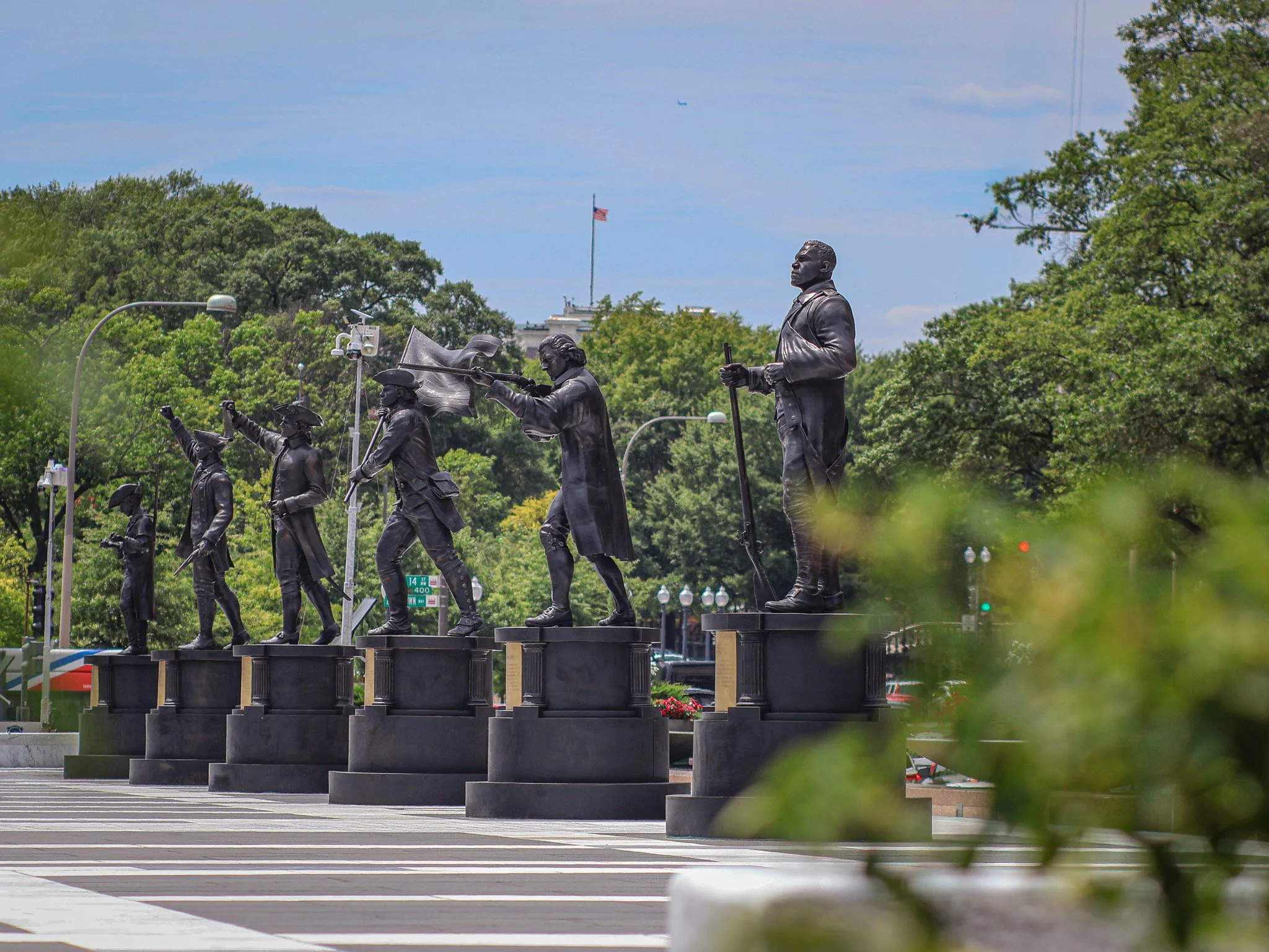
Six of many temporary (?) additions to Freedom Plaza.
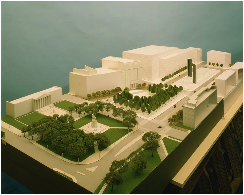
Early plans called for tall monolith-type towers and 3D models of buildings in Western (Freedom) plaza. These never made it into the final design.
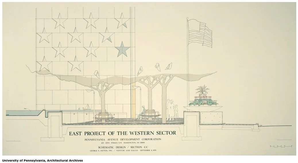
Tall monolith towers and seating concepts that are not part of the present day Freedom Plaza landscape.
Honoring the Builders of the Arboretum

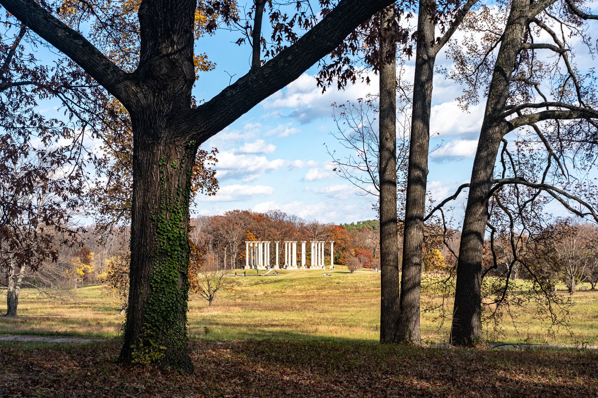
The U.S. National Arboretum is often called a "hidden gem" in DC, but there are plenty of visitors -- 700,000 yearly according to Friends of the National Arboretum. The Arboretum is a 451 acre facility in the northeast quadrant of Washington, DC. Technically, it is part of the United States Department of Agriculture, nested in the USDA's Agricultural Research Service.

While research and conservation are a part of the Arboretum's mission, so is education. It doubly serves as a research facility and a publicly available green space for visitors — in the form of a huge park. Most of those 700,000 visitors are not there for formal research, but there to take in the gardens and vast Arboretum collections including dogwoods, azaleas, bonsai, ferns, herbs, perennials, conifers, and so many others.

Created by the National Arboretum Act in 1927, the goal of the initial public gardens was to elevate plant groups important to American landscapes. The current mission statement indicated that the Arboretum "enhances the economic, environmental, and aesthetic value of ornamental and landscape plants through long-term, multi-disciplinary research, conservation of genetic resources, and interpretative gardens and exhibits." Perhaps slightly verbose, but you get an idea of what the purpose of the facility actually is, although most visitors interact with the 451 acres as a public park.

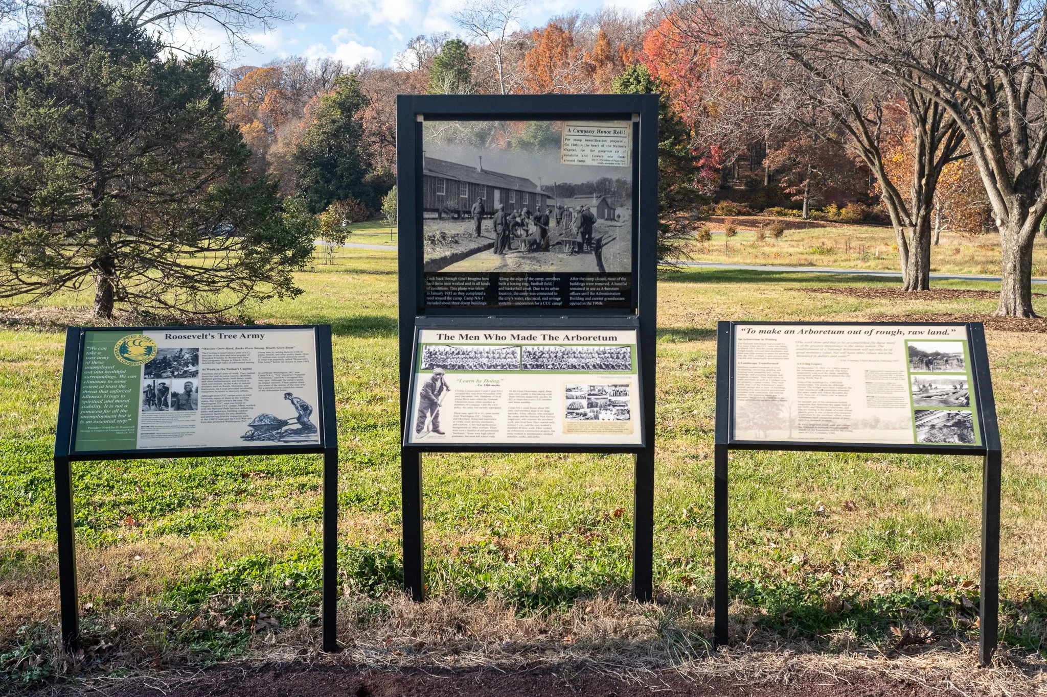
Recently the Arboretum created a display that honors some of the people that built the facility as it existed in infancy. In a small, four panel display near the old State Grove of Trees, visitors can learn a little about Company 1360.

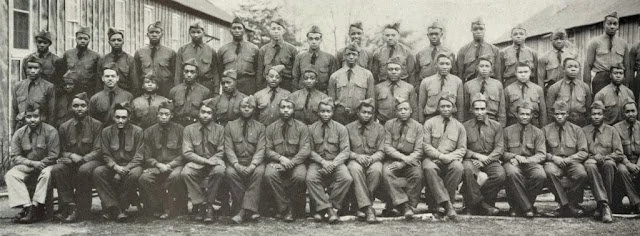
Company 1360 was a DC-based company in the Civilian Conservation Corp (CCC), a Roosevelt era federal work relief program that employed mostly young men (18-25) on environmental and conversation projects across the country. Since the United States government was still segregated at the time, Company 1360 was initially an all Black unit, and remained so for the duration of their work program. It was the first all-Black CCC encampment in the National Capital Parks area. Over the nine year duration of the CCC, about 10% of CCC enrollees were Black. However quotas capped the number of Black enrollees as well as leadership advancement opportunities within CCC, even as under-employment in the Black community exceeded the national average. All CCC enrollees were paid equally regardless of race, including Company 1360, and enrollees individually received $30 per month. They were typically required to send $25 back their families to stimulate the economy (we were still in the Great Depression) and allowed to keep $5 for themselves. All enrollees received housing, food, uniforms, enrichment, and health care.

Company 1360 at their camp on the grounds of National Arboretum. c. 1937

Company 1360 worked from 1934 to 1941 to reshape the existing farmland and forest into what we now know as the National Arboretum. They lived on-site at "Camp NA-1," off of what was an extended M Street NE, at the southern end of the Arboretum; not far from the Anacostia River flats as they exist today. Camp NA-1 was one of the 4,500 CCC camps that existed over the course of the program, which ended in 1942. It probably doesn't come as a surprise that the CCC ended as a result of World War II as U.S. government funds and attention were diverted the war effort and young men diverted into military service away form programs like the CCC.

Members of Company 1360 came from DC, Maryland, and Virginia, with the vast majority being DC residents, according to early records. The cohort was tasked with building roads, constructing bridges, grading walk paths, clearing underbrush, creating manmade ponds, seeding grass, landscaping, building offices & tool houses, moving topsoil, cutting endless cords of wood, and generally transforming the land the Arboretum existed on into the form we now experience in the present day.

Present day visitors to the property owe a small debt to the original builders of the Arboretum and I was glad to see the four panel display out in the open, although it is a decent walk from the R Street and New York Avenue entrances. The exhibition will be available for the foreseeable future and has no end date.

This post was made possible by supporters of Attucks Adams on Patreon. Join our Patreon for weekly DC history posts, additional photographs of the Arboretum, and more. NEW: Gift a Patreon membership to the history buff in your life (even if that’s you). Thanks everyone for your continued support.

DC's Alternative Art Spaces, Past & Present

DIY -- Do It Yourself. As applied to music and the arts, DIY usually signifies the show, project, or venue is produced by the artists themselves. Even though not always not-for-profit on paper, usually DIY spaces are run without being part of, or subject to direct oversight of a typical corporation, government agency, or overarching bureaucratic framework. Nor would shareholder be profit the main motive.

The idea of having multiple DIY arts spaces in downtown DC is somewhat of an anomaly today. Many of those arts spaces are located outside the downtown core in group houses, places of worship, or underutilized retail spaces.

A new exhibition (D.I.Y. in the District) located on the first floor of the MLK Library highlights alternative DIY arts spaces in DC from the 1970s to the present. From Rhizome (located in a residential setting way uptown), to d.c. space (formerly located in the heart of downtown DC), the exhibition uses venue ephemera, archival photos, and audiovisuals to show how these venues helped shape the usually unrecognized arts culture embodied in DC's local population. That is to say, the arts outside of national or international museums and organizations.

Perhaps a partial "victim of their own success," dc. space closed in 1991 as downtown DC was about to see a 30 year boom of redevelopment and new construction that continues today. That redevelopment boom transformed downtown culture to favor retail and entertainment, but much of the DIY arts scene was left out. There are art galleries, theatres, and entertainment venues downtown, but the cultural scene is dominated by larger entities such as the Smithsonian (SAAM and NPG) and the 20,000 Capital One Arena which is primarily a sports venue. But, smaller artist-run galleries such as Touchstone (1976) do still exist.

MLK Library has grown over the past decade to be a place for so many diverse resources and I'm glad these great hall exhibitions have been a part of that growth.

D.I.Y. in the District is open through December 7, 2025. 901 G St NW, Washington, DC 20001.

Support us on Patreon to receive all posts, and early!

New Tour Alert: Music & Social Change Debuts May 31

It’s official! We have a new tour. This one has been in the works off and on for a few years. I have given privately commissioned tours of Adams Morgan and Mount Pleasant in the past — but each separately. In 2019, I worked on an amazing project, co-developing a tour for the Smithsonian Folklife Festival in 2019 with friend and colleague Natalie Avery. And six months ago I was commissioned to combine both neighborhoods in a private tour that took place in early spring. It worked really well and was actually what convinced me to greenlight this tour as a new permanent offering. Here’s the description!

Music and Social Change: Mount Pleasant and Adams Morgan

Explore the deep histories of Mount Pleasant and Adams Morgan on this unique walking tour. Delve into the area's rich musical heritage, from the "hillbilly music" of the mid-20th century to the influential punk and Riot Grrrl scenes of the 1990s.

Discover how the arrival of streetcars shaped these neighborhoods, leading to bustling commercial strips and two diverse but linked communities. Learn about 16th Street's past identity as Embassy Row and uncover the origins of the Adams Morgan name, a testament to the neighborhood's commitment to racial integration.

From historic libraries and grand movie houses to the hidden stories behind local businesses and community spaces, this tour offers a captivating glimpse into the evolution of these iconic Washington, D.C. neighborhoods.

Duration: 90 minutes. About 1 mile total distance. Private group torus start at $125 and public tours are $25 per person.

The tour book is open for private bookings, but the big kick off is on May 31st, with two tours offered at 10am and 2pm. These are public tours and open to everyone. Tickets are $25. Book here!

To everyone supporting Attucks Adams on Patreon, you can register for either of the May 31 tours for half off. Email me for more information. As a reminder Patrons get early and behind the scenes access to my research and photos that inform the tours themselves.If you’re interested in joining Patreon, check out the tiers here!

A final note — I lived in Mount Pleasant for nearly 15 years. Mount P and Adams Morgan are both near and dear to my heart and really important to how I view DC as a long time resident. I hope that comes through in the tour.

This has been a fun tour to build an I look forward to growing it, adapting to how the neighborhood changes, and sharing even more about another DC neighborhood with the world!

The Future of Telling Stories Part II: Tours

In 1862 a man named Charles Stuart traveled to the Washington City Hall building on Indiana Avenue and turned in a set of important and valuable papers. The papers documented 10 people that were enslaved by Stuart. Enslaved — in the past tense. On April 16th, 1862 President Abraham Lincoln signed the District of Columbia Emancipation Act, freeing all enslaved people in the District of Columbia.

This was a full 8 months before the Emancipation Proclamation freed enslaved people in the rebellious southern states. In DC, there were 10,000 Black people living within the borders of the capital in 1862, but only about 3,100 were enslaved. Most Black people in DC were free. Those enslaved Black people became free under this act of Congress. However, enslavers in DC were given reparations for loss of their “property.” Enslavers like Charles Stuart could petition the government to get up to $300 per enslaved person they “lost” under the act. Each enslaved person could receive up to $100, but only if they engaged in "voluntary emigration,” i.e., leaving the United States for countries such as Liberia or Haiti. I discuss all of this and more on a tour titled Eyes on Emancipation: Black History on Pennsylvania Avenue.

The buying and selling of people, the compensation of enslavers, and the related histories are not fun facts to be relayed on a walking tour. However, these stories give context and meaning to the sites we see on tour. And these enable a better understanding the 150 years of political and cultural development that occurred here in DC post-emancipation. 99% of my guests understand this. They understand that the history of the United States is fraught. There are gruesome parts, frustrating parts, repellent parts, and dismal parts. There are also stories of triumph, inspiration, revolution, advancement, and preservation. All of those moments are part of the historical fabric of this nation and of this District. Can I cover it all on a 90 minute tour? No, of course not. But I trust my guests to let my storytelling be a guide to how they reckon with the present by way of understanding the past. Each person does it in their own way and I always plan to connect with different learners in different ways. 

What we must not be forced to do as educators is to edit the historical content of programs because of so-called “divisive” topics. I have no doubt that the principle behind the recent Executive Order concerning Smithsonian museums (I wrote about last week) will make its way to other educational venues. Of course K-12 classrooms come to mind, out-of-school learning programs, colleges & universities, and beyond. 

There is a fine line between worrying too much about a theoretical, potential scenario and actually preparing for what is likely to come. In that vein, I am prepared for walking tours and other informal teaching spaces to be challenged. The 250th anniversary of our nation, by way of the Declaration of Independence, is upon us. People from around the world will look not just to Washington, DC, but all corners of the United States as we reflect on, well… how we’re doing at the quarter millennium mark as a nation. Part of the reflection is learning about the problematic and tough parts of our shared history.

I can not edit those parts out of the narrative. I do not delight in telling the Charles Stuart story, but if did happen. Slavery was an institution. But then it came to an end here in DC, and later the U.S. This was partially due people like Charles Stuart complying and also due to the steadfast bravery of the United States Colored Troops, which we also teach about on tour.

Does discussing these topics "...degrade shared American values?" Does shining a light on the USCT "...divide Americans based on race?" Does explaining compensated emancipation "...promote programs or ideologies inconsistent with Federal law and policy?" In my view, of course not. I believe most of my guests agree. The day may come when tour guiding and other forms of speech & teaching are challenged on these grounds. In the meantime, I will continue to keep learning, updating current tours, and introducing new tours all about DC and how we got from there to here and then to now. The future of telling stories is good.