
This is Part I of a III Part series. Please join and support us on Patreon to read the the rest!
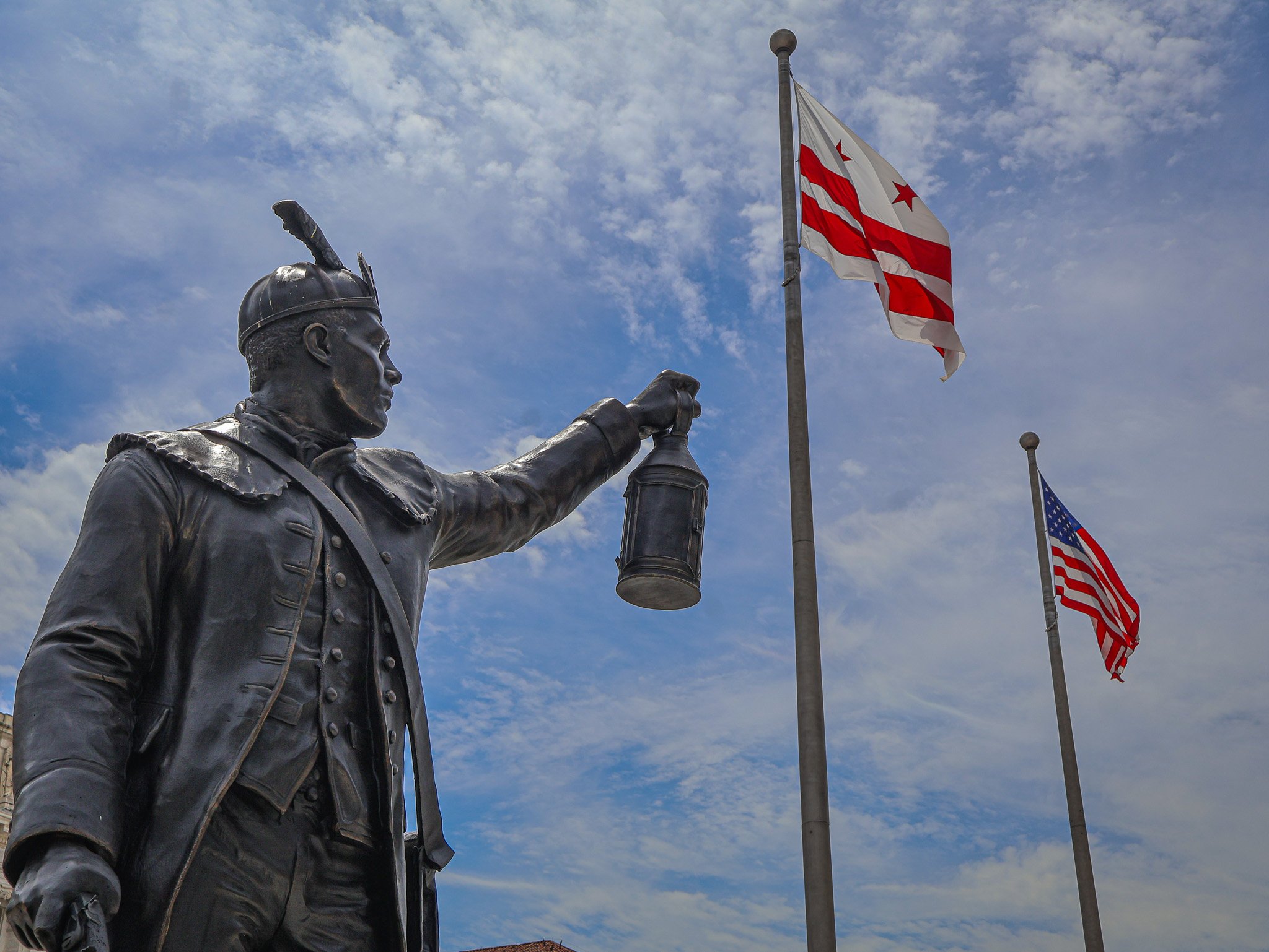
Statue of Jack Sisson. One of more than a dozen new statues added to Freedom Plaza over the past year.
Over the past calendar year downtown DC’s Freedom Plaza has been transformed and updated, with some changes permanent and others temporary. Reopening this summer after a long closure dating back to the early winter months, the plaza has seen the addition of a cadre of statues, updated quotations, and a renovated water fountain. In this series, I will explore the origins of Freedom Plaza, some of the key infrastructure changes, cover each of the new statues including who (or what) they commemorate, and how the meaning of Freedom Plaza has changed over the last 40 years.
Part I: Origins of Freedom Plaza
Freedom Plaza is the name of a rectangular, city block-sized park located just southeast of the White House and north of the National Mall area. The park is bounded by 13th Street, 14th Street, and a split Pennsylvania Ave on the north and south sides, although some maps still label the north side of Penn Ave as E Street. Across the southern edge of Freedom Plaza is the John A. Wilson Building, the home of DC's local municipal government. The Wilson Building has its own adjacent statues, Alexander Shepherd and Marion Barry.
Freedom Plaza dates back to 1980 and was originally named Western Plaza. In 1974 a new Congressionally established agency, the Pennsylvania Avenue Development Corporation (PADC), created a report to guide the next few decades of growth along the Avenue corridor. The PADC’s main goal was to revitalize the portion of the Avenue between the White House and the Capitol. In order to accomplish this goal, they set ambitious objectives including making Pennsylvania Avenue more attractive and practical for pedestrians, preserving existing historic structures on the Avenue and its side streets, and establishing new spaces for commercial, residential, and cultural venues. The PADC’s work spanned from basic projects like repaving the roadway and sidewalk landscaping all the way to establishing complex public-private partnerships with developers to create new buildings that aligned with PADC plans.
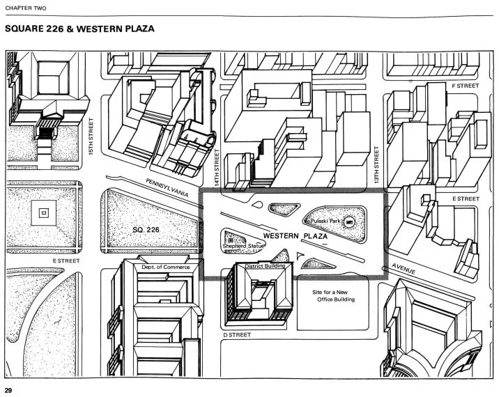
Illustration of the area around Western Plaza before it was consolidated into an actual park.
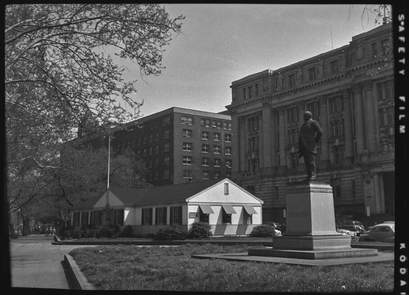
1952 pre-Western Plaza photo of the Veterans Information Center and Shepherd statue, in front of the District Building.
The proposal that resulted in the creation of Western Plaza leaned on the original L’Enfant plan of Washington, which included a plaza on this site. In the late 1970s, this area was bisected by car travel lanes of Pennsylvania Avenue (see illustration above). On each side of the thoroughfare were two smaller existing pocket parks, one of which already held a statue of General Casimir Pulaski (now in Freedom Plaza), and the other a statue of Alexander Shepherd (now at the Wilson Building).
One of the goals of Western Plaza was to better frame and present the District Building (now known as the John A. Wilson Building) from Pennsylvania Ave, as well as any future buildings on the land next to the District Building. Those lots ended up becoming the massive Ronald Reagan Building and International Trade Center. The design of Western Plaza is credited to the firm Venturi, Rauch & Scott Brown with additional contributions from George E. Patton.
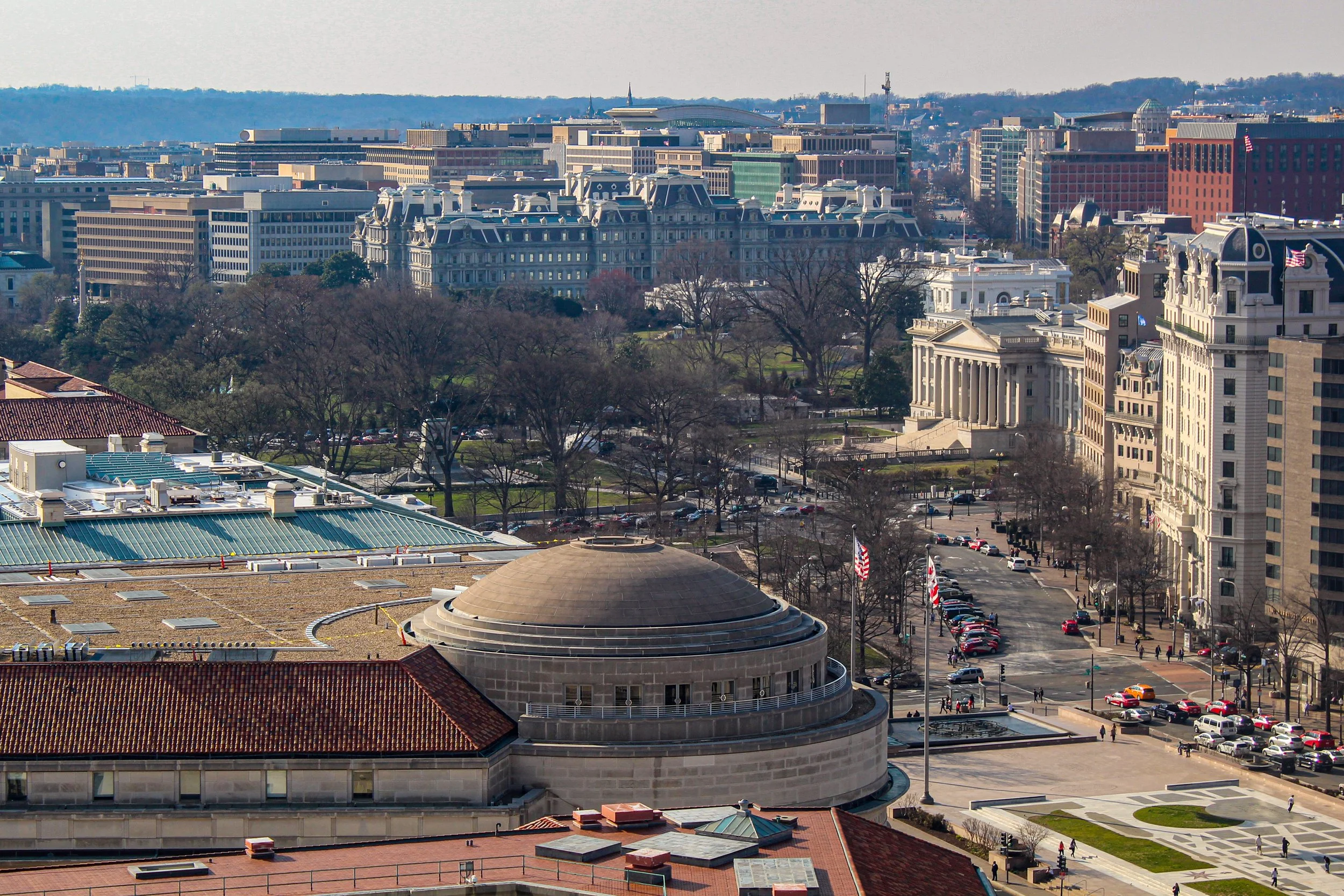
Freedom Plaza (lower right) is one block from the U.S. Treasury and the White House. The domed Trade Center building is seen at center.
The plaza was planned to be a place for workers or visitors to escape the busy city sidewalks, despite much of the plaza being an open stone plinth with little tree cover or seating. The main artistic element is an oversized blueprint style, 1887-era map of the L’Enfant plan, specifically the part of the city linking the White House to the U.S. Capitol. Early plans included three dimensional models of the White House and Capitol Building to be placed on the plaza, but those were ultimately scrapped. What did make it into the plaza were multiple historic quotations that are incised across the Plaza’s floor. Quotes range from selections from the Constitution, to literary giants, presidents, civil rights leaders, and others from the first 200 years of American history. Once completed in 1980, the plaza remained essentially static over the past 40 years, except for one big change.
In 1988 the name of Western Plaza was changed to Freedom Plaza to honor Dr. Martin Luther King, Jr. 1988 marked 20 years since the assassination of Dr. King and 5 years since his birthday became a federal holiday. King also stayed at the adjacent Willard Hotel before the March on Washington in 1963. To mark the plaza’s name change, a time capsule was placed under the plaza, set to be opened in 100 years time (2088), when we are set to reflect on Dr. King's legacy more than a century after the Civil Rights Movement. The capsule contains one of King’s bibles, a clerical robe, cassette tapes of a number of his speeches, and a special U.S. flag with 51 stars, a nod to potential statehood status for Washington, DC. Dr. King supported local control for the residents of DC, and a version of home rule was passed into law after his death, in 1973. More than a decade later, Congress authorized the King time capsule by Joint Resolution in 1987.
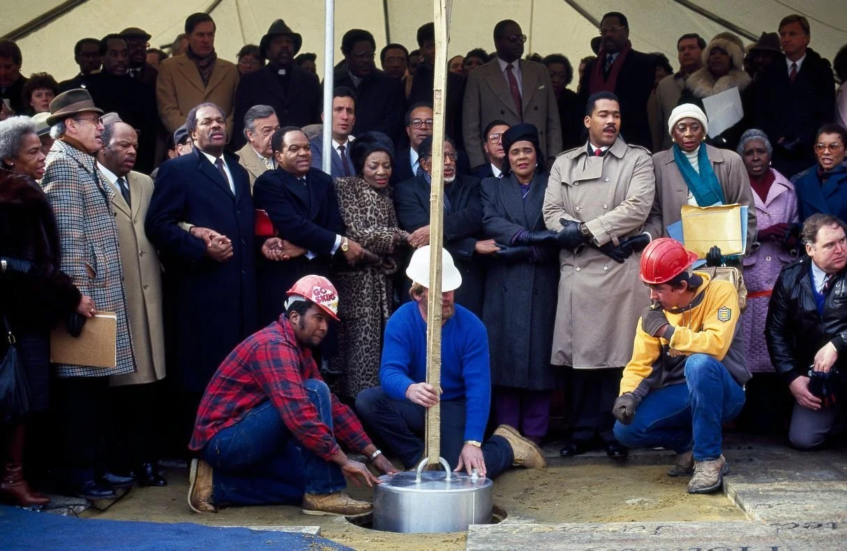
Coretta Scott King and others gather to dedicate Dr. King's time capsule in 1988.
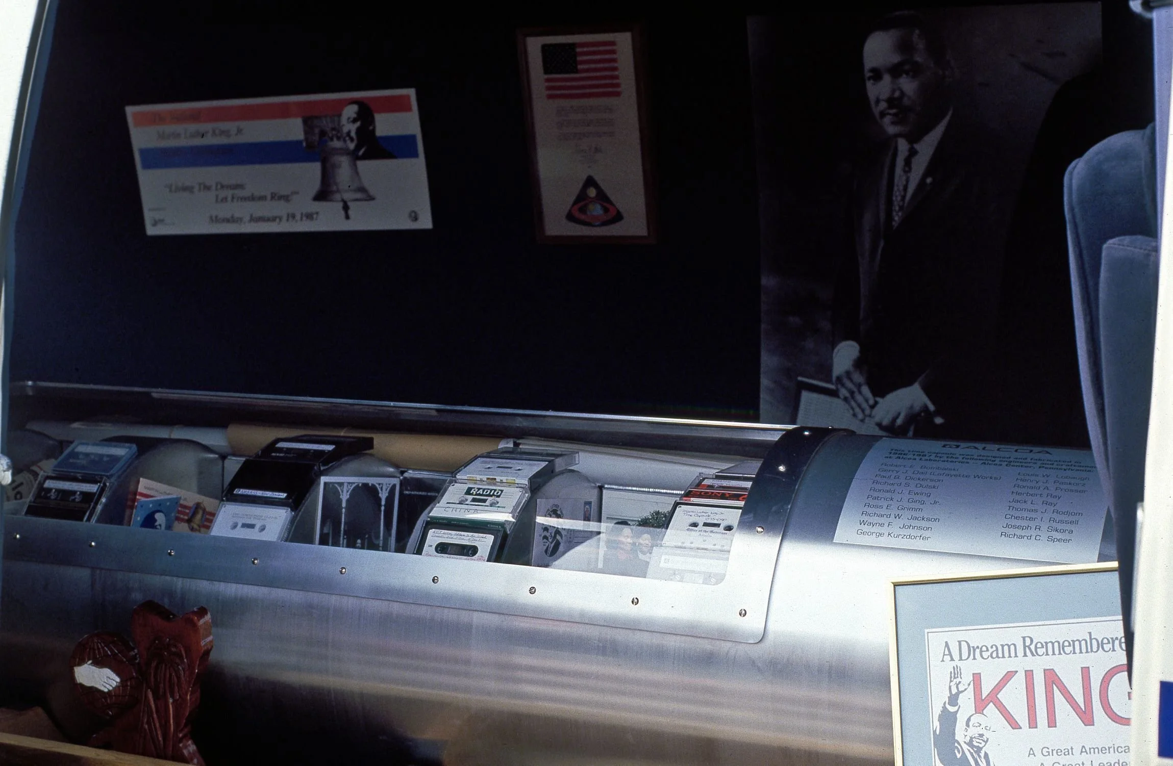
The time capsule before being lowered into the ground.
Since 1980 Freedom Plaza has indeed been a public commons of sorts, acting as a flex space for all types of gatherings. It’s been the home base of protest marches and demonstrations, a stage for musical performances, home to the annual celebration of Emancipation Day in DC, the start & end point to many road races and marathons, witness to every Presidential Inaugural parade since 1980, the location of temporary outdoor exhibitions, and as a transitional space between the National Mall and the commercial area of downtown DC.
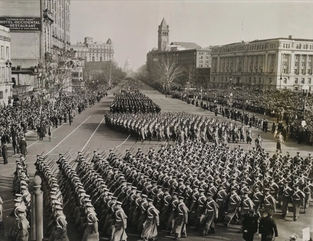
Parade for Franklin Roosevelt's third Presidential Inauguration in 1941. This area became Western Plaza 40 years later.
By 2020, the vision for Freedom Plaza and Pennsylvania Avenue established by the PADC had run its course. The National Capital Planning Commission is currently operating under a new plan with a similar name, the Pennsylvania Avenue Initiative.
Aside from the greater Pennsylvania Avenue Initiative, over the course of this year, the Plaza has been transformed in accordance with the larger acknowledgments of the 250th anniversary of the Declaration of Independence. A number of statues have been added to the park, ostensibly by the Department of the Interior and the National Park Service. Including a statue of the allegorical Spirit of Liberty, more than a dozen new statues have been added to Freedom Plaza in 2026, all representing men from the era of the American Revolution. The first added and most prominent of the new statues of the group is of Delaware's Caesar Rodney.
In Part II of this adventure guide we’ll take a close look at the Rodney statue as well as all the new additions, who the new statues represent, what the purpose of the new additions are, how they still qualify as ephemeral even though they are in the form of semi-permanent statuary. And in Part III we’ll tie it all together, diving into the identities of the other new statues on the plinth and what what says about the new narrative of Freedom Plaza.
Continue the journey with Part II: Commemorations on Commemoration and Part III: A New Narrative and a New Reflection.
Want to experience this in person? We see all this and more on our Eyes on Emancipation Pennsylvania Avenue tour. See the tour schedule here or contact us for a private tour.
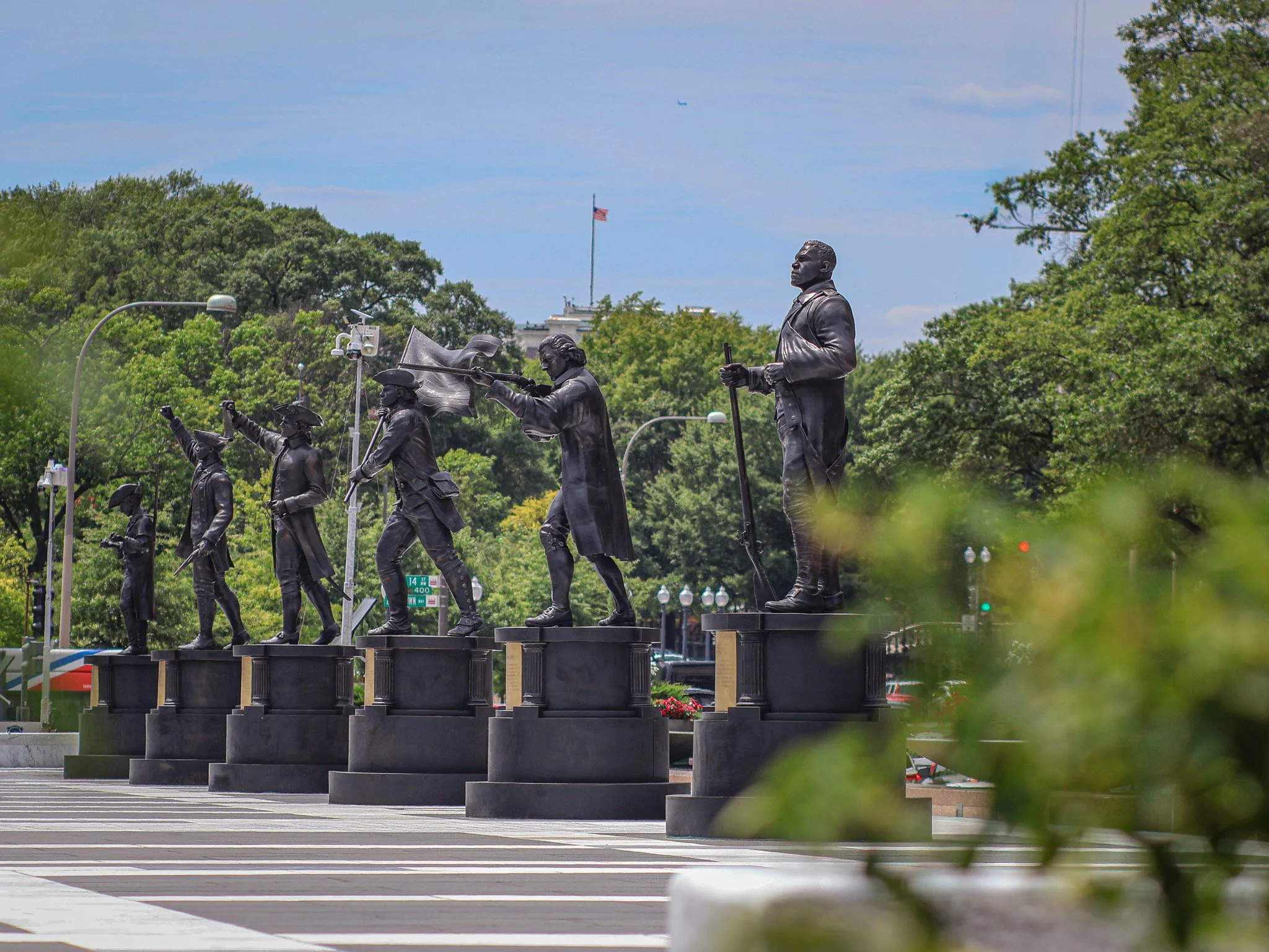
Six of many temporary (?) additions to Freedom Plaza.
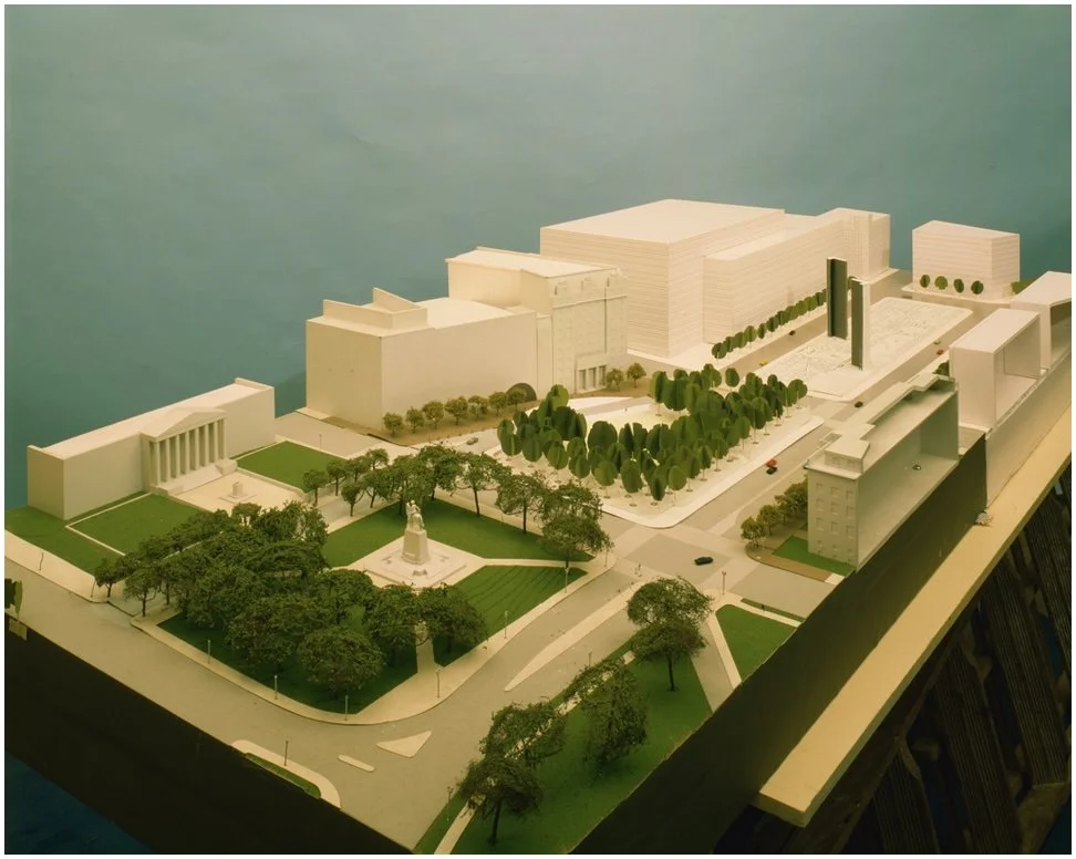
Early plans called for tall monolith-type towers and 3D models of buildings in Western (Freedom) plaza. These never made it into the final design.
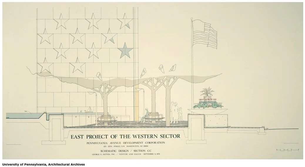
Tall monolith towers and seating concepts that are not part of the present day Freedom Plaza landscape.