memorials

Freedom Plaza Part I: Origins

This is Part I of a III Part series. Please join and support us on Patreon to read the the rest!
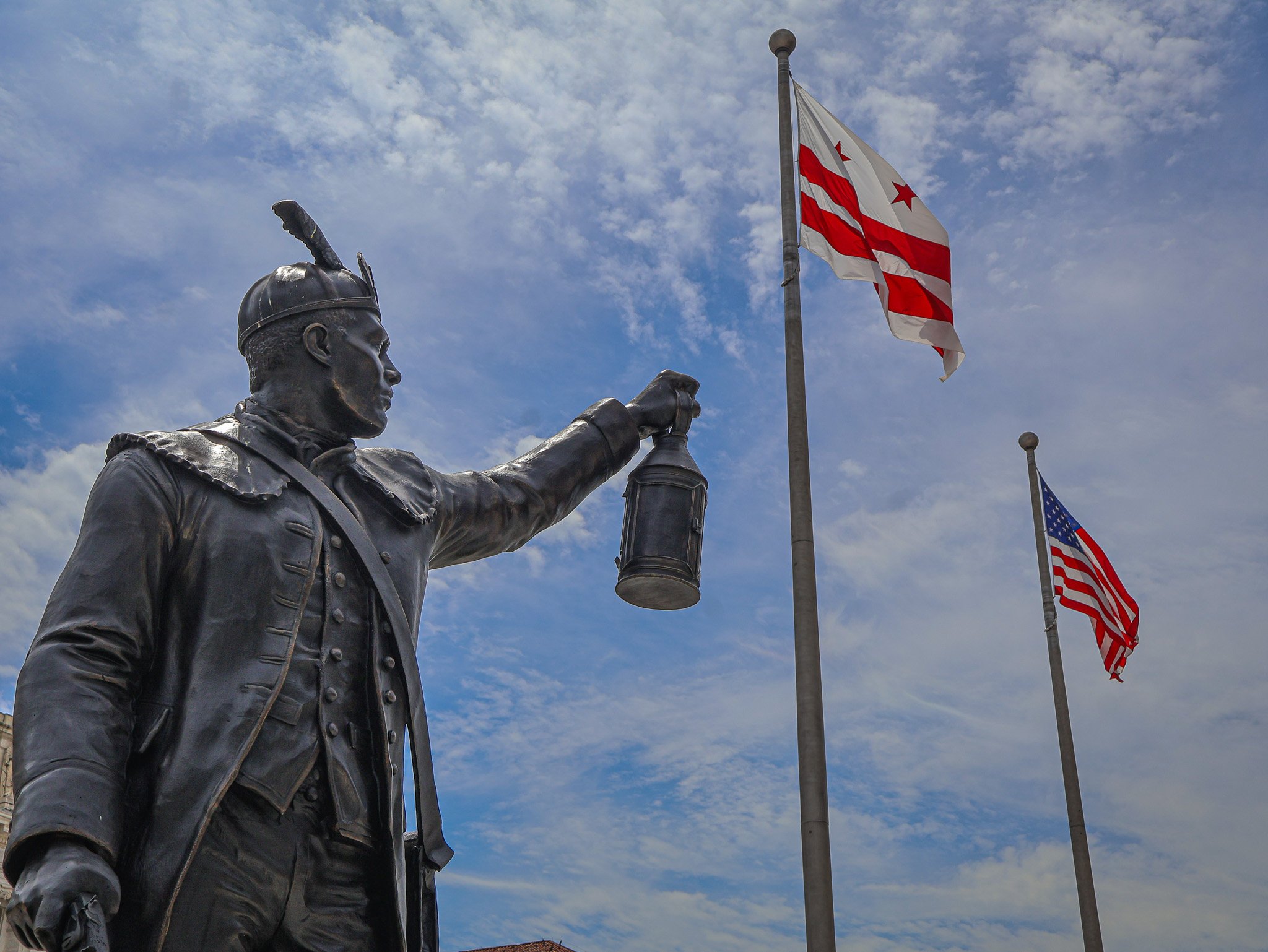
Statue of Jack Sisson. One of more than a dozen new statues added to Freedom Plaza over the past year.

Over the past calendar year downtown DC’s Freedom Plaza has been transformed and updated, with some changes permanent and others temporary. Reopening this summer after a long closure dating back to the early winter months, the plaza has seen the addition of a cadre of statues, updated quotations, and a renovated water fountain. In this series, I will explore the origins of Freedom Plaza, some of the key infrastructure changes, cover each of the new statues including who (or what) they commemorate, and how the meaning of Freedom Plaza has changed over the last 40 years.

Part I: Origins of Freedom Plaza

Freedom Plaza is the name of a rectangular, city block-sized park located just southeast of the White House and north of the National Mall area. The park is bounded by 13th Street, 14th Street, and a split Pennsylvania Ave on the north and south sides, although some maps still label the north side of Penn Ave as E Street. Across the southern edge of Freedom Plaza is the John A. Wilson Building, the home of DC's local municipal government. The Wilson Building has its own adjacent statues, Alexander Shepherd and Marion Barry.

Freedom Plaza dates back to 1980 and was originally named Western Plaza. In 1974 a new Congressionally established agency, the Pennsylvania Avenue Development Corporation (PADC), created a report to guide the next few decades of growth along the Avenue corridor. The PADC’s main goal was to revitalize the portion of the Avenue between the White House and the Capitol. In order to accomplish this goal, they set ambitious objectives including making Pennsylvania Avenue more attractive and practical for pedestrians, preserving existing historic structures on the Avenue and its side streets, and establishing new spaces for commercial, residential, and cultural venues. The PADC’s work spanned from basic projects like repaving the roadway and sidewalk landscaping all the way to establishing complex public-private partnerships with developers to create new buildings that aligned with PADC plans. 
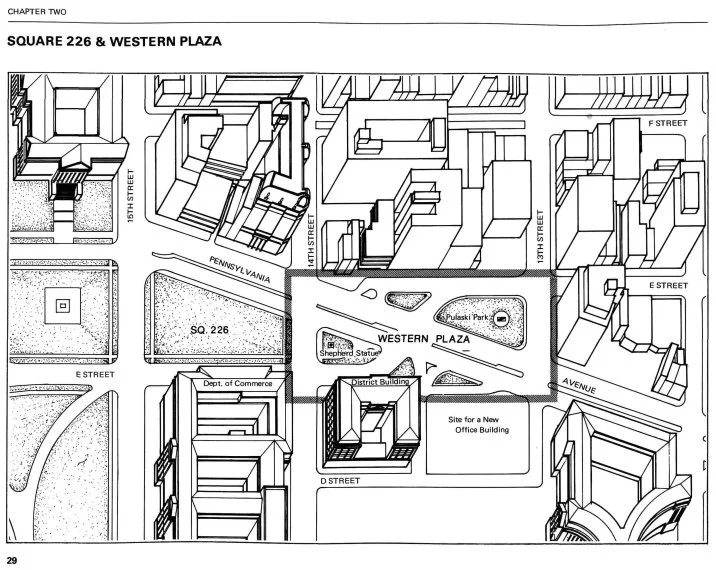
Illustration of the area around Western Plaza before it was consolidated into an actual park.
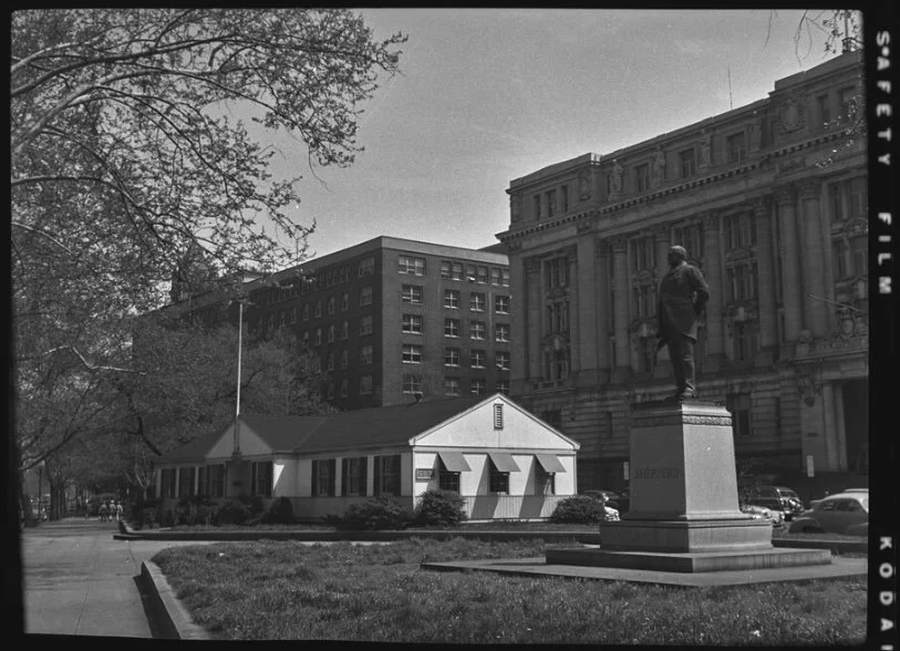
1952 pre-Western Plaza photo of the Veterans Information Center and Shepherd statue, in front of the District Building.

The proposal that resulted in the creation of Western Plaza leaned on the original L’Enfant plan of Washington, which included a plaza on this site. In the late 1970s, this area was bisected by car travel lanes of Pennsylvania Avenue (see illustration above). On each side of the thoroughfare were two smaller existing pocket parks, one of which already held a statue of General Casimir Pulaski (now in Freedom Plaza), and the other a statue of Alexander Shepherd (now at the Wilson Building).

One of the goals of Western Plaza was to better frame and present the District Building (now known as the John A. Wilson Building) from Pennsylvania Ave, as well as any future buildings on the land next to the District Building. Those lots ended up becoming the massive Ronald Reagan Building and International Trade Center. The design of Western Plaza is credited to the firm Venturi, Rauch & Scott Brown with additional contributions from George E. Patton.
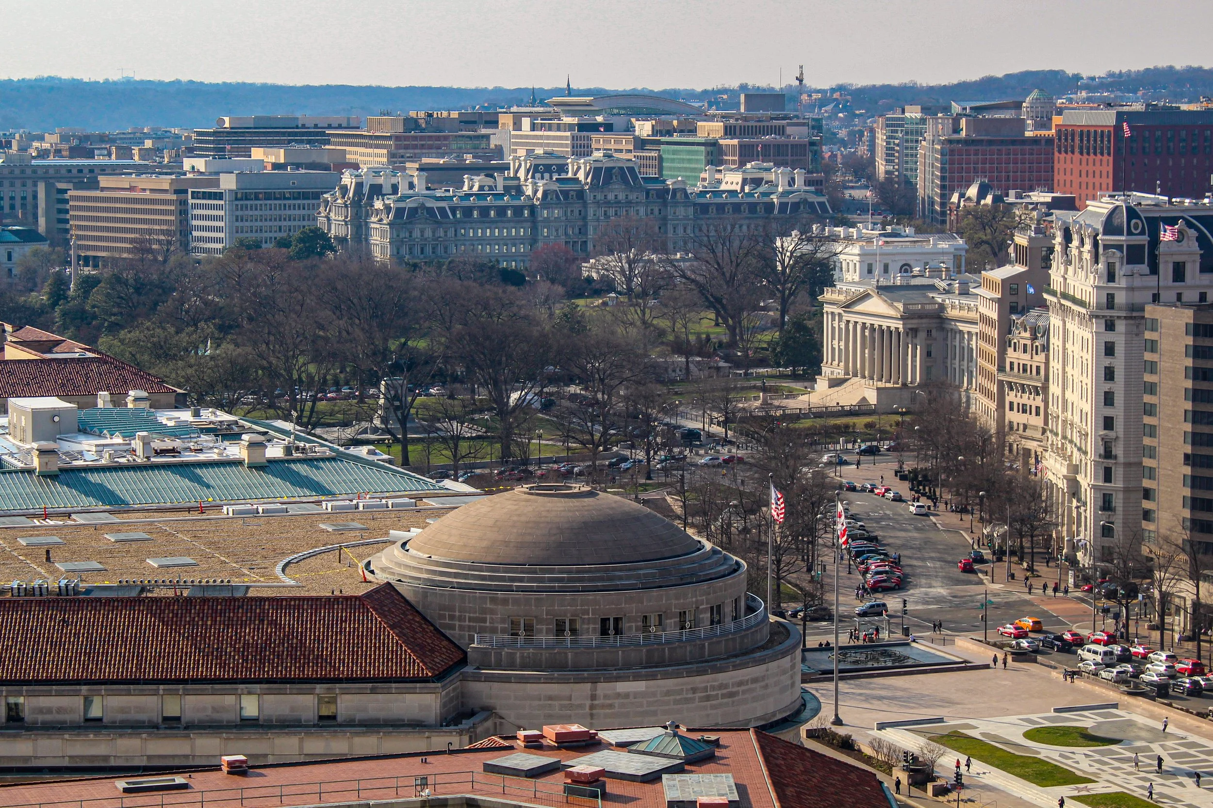
Freedom Plaza (lower right) is one block from the U.S. Treasury and the White House. The domed Trade Center building is seen at center.

The plaza was planned to be a place for workers or visitors to escape the busy city sidewalks, despite much of the plaza being an open stone plinth with little tree cover or seating. The main artistic element is an oversized blueprint style, 1887-era map of the L’Enfant plan, specifically the part of the city linking the White House to the U.S. Capitol. Early plans included three dimensional models of the White House and Capitol Building to be placed on the plaza, but those were ultimately scrapped. What did make it into the plaza were multiple historic quotations that are incised across the Plaza’s floor. Quotes range from selections from the Constitution, to literary giants, presidents, civil rights leaders, and others from the first 200 years of American history. Once completed in 1980, the plaza remained essentially static over the past 40 years, except for one big change.

In 1988 the name of Western Plaza was changed to Freedom Plaza to honor Dr. Martin Luther King, Jr. 1988 marked 20 years since the assassination of Dr. King and 5 years since his birthday became a federal holiday. King also stayed at the adjacent Willard Hotel before the March on Washington in 1963. To mark the plaza’s name change, a time capsule was placed under the plaza, set to be opened in 100 years time (2088), when we are set to reflect on Dr. King's legacy more than a century after the Civil Rights Movement. The capsule contains one of King’s bibles, a clerical robe, cassette tapes of a number of his speeches, and a special U.S. flag with 51 stars, a nod to potential statehood status for Washington, DC. Dr. King supported local control for the residents of DC, and a version of home rule was passed into law after his death, in 1973. More than a decade later, Congress authorized the King time capsule by Joint Resolution in 1987.
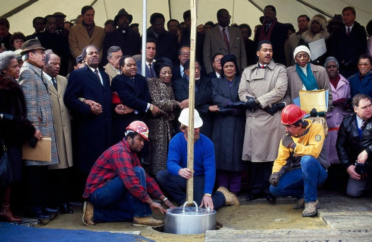
Coretta Scott King and others gather to dedicate Dr. King's time capsule in 1988.
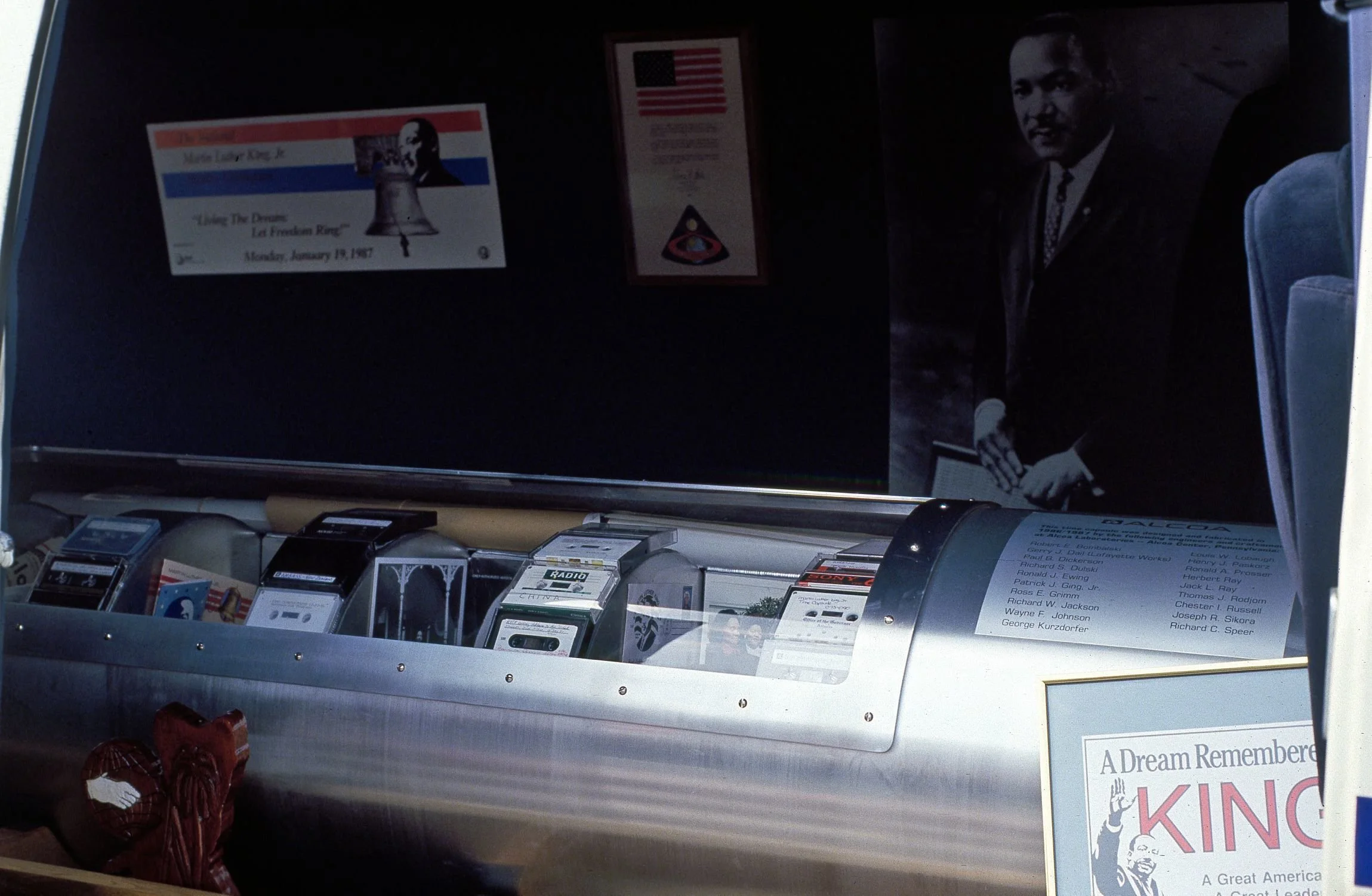
The time capsule before being lowered into the ground.

Since 1980 Freedom Plaza has indeed been a public commons of sorts, acting as a flex space for all types of gatherings. It’s been the home base of protest marches and demonstrations, a stage for musical performances, home to the annual celebration of Emancipation Day in DC, the start & end point to many road races and marathons, witness to every Presidential Inaugural parade since 1980, the location of temporary outdoor exhibitions, and as a transitional space between the National Mall and the commercial area of downtown DC.
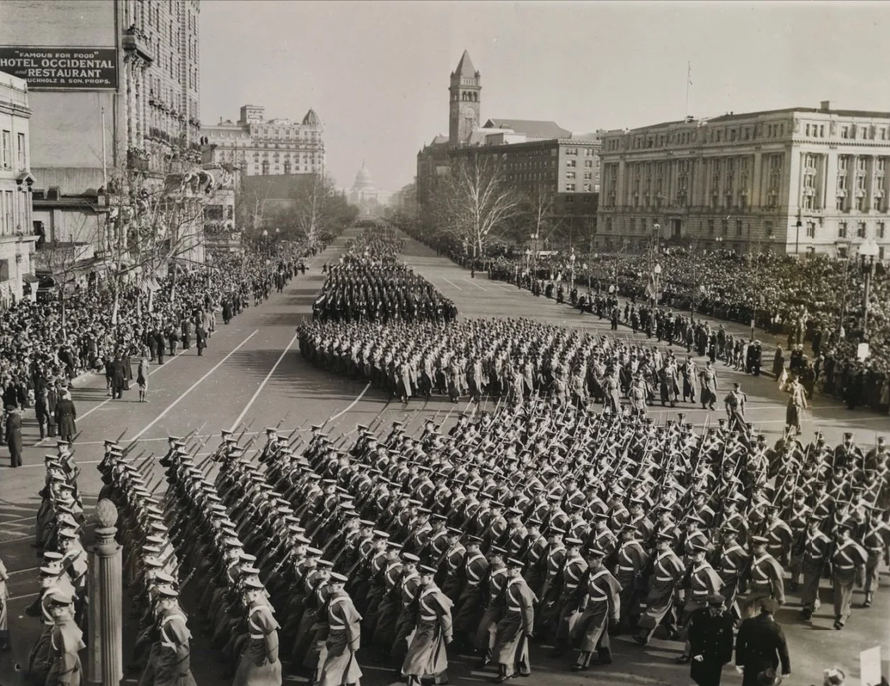
Parade for Franklin Roosevelt's third Presidential Inauguration in 1941. This area became Western Plaza 40 years later.

By 2020, the vision for Freedom Plaza and Pennsylvania Avenue established by the PADC had run its course. The National Capital Planning Commission is currently operating under a new plan with a similar name, the Pennsylvania Avenue Initiative

Aside from the greater Pennsylvania Avenue Initiative, over the course of this year, the Plaza has been transformed in accordance with the larger acknowledgments of the 250th anniversary of the Declaration of Independence. A number of statues have been added to the park, ostensibly by the Department of the Interior and the National Park Service. Including a statue of the allegorical Spirit of Liberty, more than a dozen new statues have been added to Freedom Plaza in 2026, all representing men from the era of the American Revolution. The first added and most prominent of the new statues of the group is of Delaware's Caesar Rodney. 

In Part II of this adventure guide we’ll take a close look at the Rodney statue as well as all the new additions, who the new statues represent, what the purpose of the new additions are, how they still qualify as ephemeral even though they are in the form of semi-permanent statuary. And in Part III we’ll tie it all together, diving into the identities of the other new statues on the plinth and what what says about the new narrative of Freedom Plaza.

Continue the journey with Part II: Commemorations on Commemoration and Part III: A New Narrative and a New Reflection.

Want to experience this in person? We see all this and more on our Eyes on Emancipation Pennsylvania Avenue tour. See the tour schedule here or contact us for a private tour.
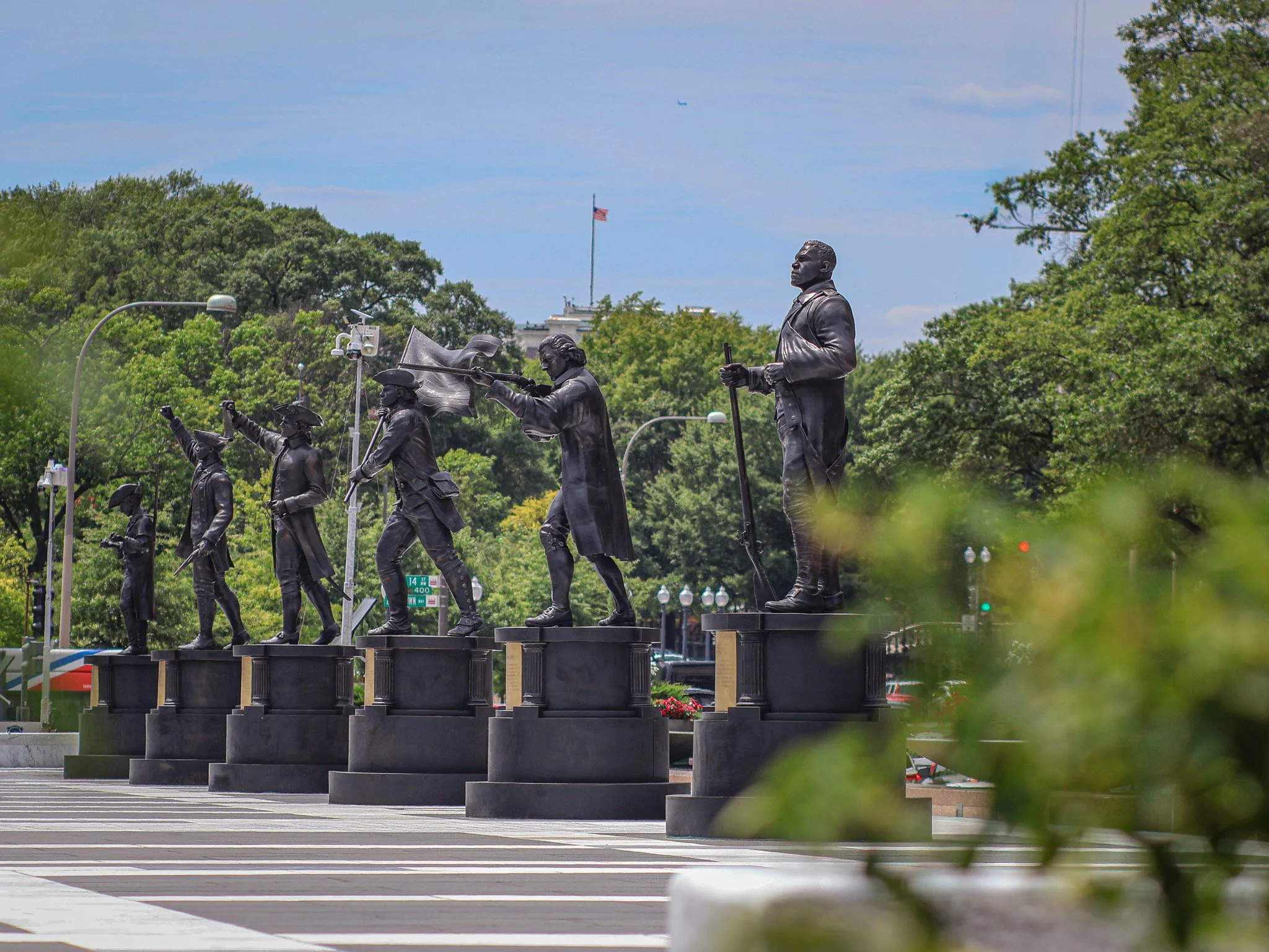
Six of many temporary (?) additions to Freedom Plaza.
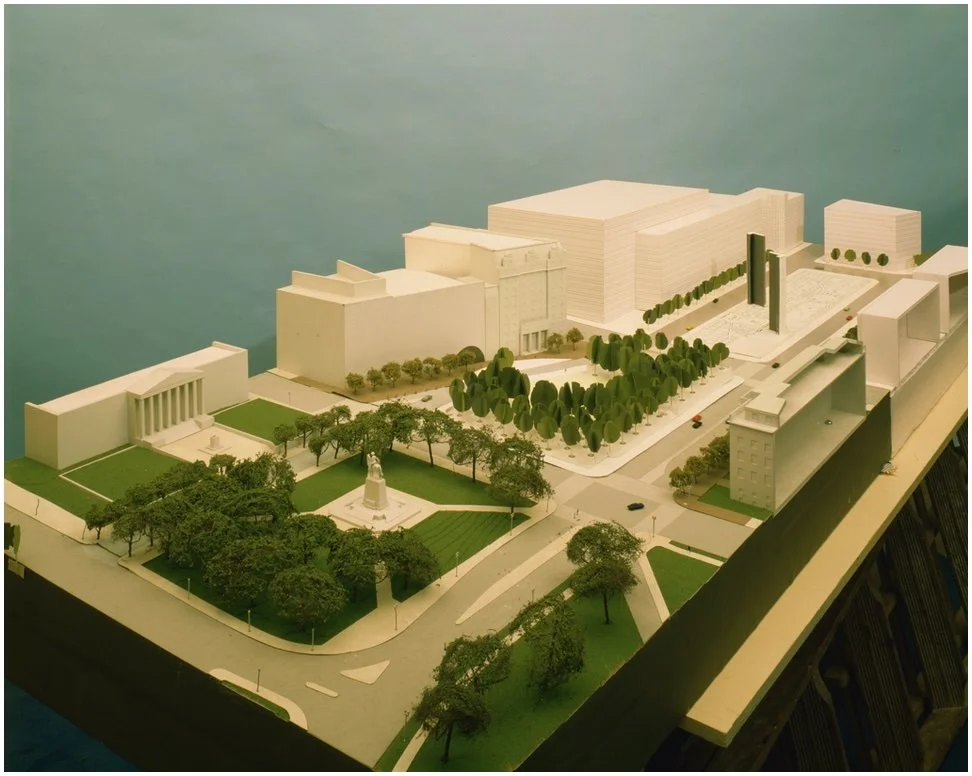
Early plans called for tall monolith-type towers and 3D models of buildings in Western (Freedom) plaza. These never made it into the final design.
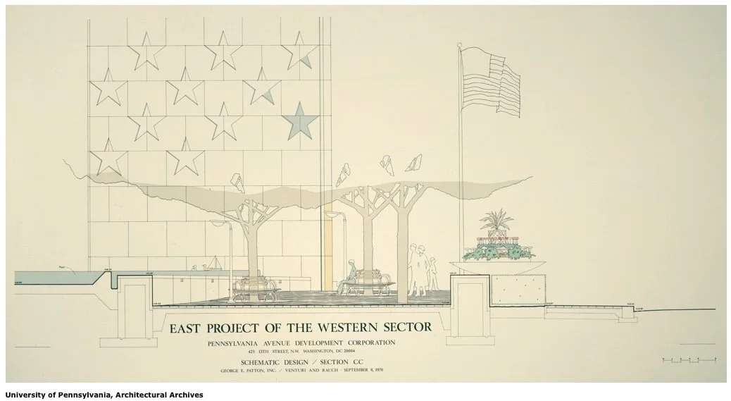
Tall monolith towers and seating concepts that are not part of the present day Freedom Plaza landscape.

The Future of Telling Stories Part II: Tours

In 1862 a man named Charles Stuart traveled to the Washington City Hall building on Indiana Avenue and turned in a set of important and valuable papers. The papers documented 10 people that were enslaved by Stuart. Enslaved — in the past tense. On April 16th, 1862 President Abraham Lincoln signed the District of Columbia Emancipation Act, freeing all enslaved people in the District of Columbia.

This was a full 8 months before the Emancipation Proclamation freed enslaved people in the rebellious southern states. In DC, there were 10,000 Black people living within the borders of the capital in 1862, but only about 3,100 were enslaved. Most Black people in DC were free. Those enslaved Black people became free under this act of Congress. However, enslavers in DC were given reparations for loss of their “property.” Enslavers like Charles Stuart could petition the government to get up to $300 per enslaved person they “lost” under the act. Each enslaved person could receive up to $100, but only if they engaged in "voluntary emigration,” i.e., leaving the United States for countries such as Liberia or Haiti. I discuss all of this and more on a tour titled Eyes on Emancipation: Black History on Pennsylvania Avenue.

The buying and selling of people, the compensation of enslavers, and the related histories are not fun facts to be relayed on a walking tour. However, these stories give context and meaning to the sites we see on tour. And these enable a better understanding the 150 years of political and cultural development that occurred here in DC post-emancipation. 99% of my guests understand this. They understand that the history of the United States is fraught. There are gruesome parts, frustrating parts, repellent parts, and dismal parts. There are also stories of triumph, inspiration, revolution, advancement, and preservation. All of those moments are part of the historical fabric of this nation and of this District. Can I cover it all on a 90 minute tour? No, of course not. But I trust my guests to let my storytelling be a guide to how they reckon with the present by way of understanding the past. Each person does it in their own way and I always plan to connect with different learners in different ways. 

What we must not be forced to do as educators is to edit the historical content of programs because of so-called “divisive” topics. I have no doubt that the principle behind the recent Executive Order concerning Smithsonian museums (I wrote about last week) will make its way to other educational venues. Of course K-12 classrooms come to mind, out-of-school learning programs, colleges & universities, and beyond. 

There is a fine line between worrying too much about a theoretical, potential scenario and actually preparing for what is likely to come. In that vein, I am prepared for walking tours and other informal teaching spaces to be challenged. The 250th anniversary of our nation, by way of the Declaration of Independence, is upon us. People from around the world will look not just to Washington, DC, but all corners of the United States as we reflect on, well… how we’re doing at the quarter millennium mark as a nation. Part of the reflection is learning about the problematic and tough parts of our shared history.

I can not edit those parts out of the narrative. I do not delight in telling the Charles Stuart story, but if did happen. Slavery was an institution. But then it came to an end here in DC, and later the U.S. This was partially due people like Charles Stuart complying and also due to the steadfast bravery of the United States Colored Troops, which we also teach about on tour.

Does discussing these topics "...degrade shared American values?" Does shining a light on the USCT "...divide Americans based on race?" Does explaining compensated emancipation "...promote programs or ideologies inconsistent with Federal law and policy?" In my view, of course not. I believe most of my guests agree. The day may come when tour guiding and other forms of speech & teaching are challenged on these grounds. In the meantime, I will continue to keep learning, updating current tours, and introducing new tours all about DC and how we got from there to here and then to now. The future of telling stories is good.

Top 5 Blossom Tips

Thanks to all Patreon supporters for making this list possible. Patrons get the full Top 10 list.

A few weeks ago the National Park Service predicted that the peak bloom period for DC's Cherry Blossom trees on the National Mall would be March 22-25. Peak Bloom is defined as the day or days when 70% of the Yoshino Cherry Blossom trees are in full bloom. There are other varietals, but Yoshino is by far the most common.

The March 22 predication was almost spot on. After visiting over the past few days, to me, it does appear that peak bloom will begin either today (March 22), or perhaps tomorrow, then last for 3-5 days before the blooms start to transition and the pedals give way to green leaves for the rest of the summer.

Considering the unique nature of visiting this part of DC at this time of year, here are my Top 10  tips for visiting the blossoms on the Tidal Basin during peak bloom.

Bring a real camera: Most modern smart phones have decent wide angle cameras. They'll pick up the color and essence of the blossoms and capture you there beside them in a quick selfie. But for more artistic shots -- nothing beats utilizing a zoom lens, more pixels, and sharper in-focus shots using your "real" camera, if you have one. Even a decent compact point & shoot will give you a leg up on most smart phone photography. And DSLR and SLRs with interchangeable lenses will do you even better. You can still save the photos to iCloud or Google Photos it you want to process them through your phone for that "punchy," saturated look. All social media sites compress even the best photos, but starting off with a high quality photo will make your posts stand out that much more.

Bring you patience: Everyone is trying to get the same shot and same view as you are. And they'll usually willing to go off the beaten path, stand right in the middle of your shot, and do basically any other annoying thing to get their own shot. Be prepared to wait it out to get the perfect phot or experience that perfect vista.

Eat beforehand: There are limited places to get prepared food down on the Tidal Basin. Whether you find the few permitted food trucks on West Basin Drive or the refreshment stands near the Lincoln Memorial, you'll be in line for 15-20 minutes for food. Eat before you head down to the mall. Alternatively, there are many places to fold out that blanket and picnic; including the ball fields across from the Franklin Roosevelt Memorial at West Potomac Park, and the grassy areas around the George Mason Memorial.

Don't drive too close to the blossoms: West Basin Drive will be closed for much of the National Cherry Blossom Festival (March 18-April 16). In addition, traffic on Ohio Drive will mostly be restricted to eastbound (westbound traffic is diverted to East Potomac Park). This means vehicle traffic near the memorials will be slow and street parking almost impossible to come by. There are a few public lots on East Potomac Park, but remember, there are dozens of other drivers looking for the same spot you are looking for. If you do need or want to drive, consider parking on the National Mall near the Smithsonian Museums. Then walk to 15th Street/Raoul Wallenberg Pl NW and head down to the Jefferson Memorial.

Prepare to walk a few miles: Say you get lucky and find a parking space on Ohio Drive next to the FDR Memorial. Great! Keep that spot as long as you legally can. And be prepared to walk. The Tidal Basin is a 2.1 mile loop all the way around. And if you want to get every blossom shot from every angle, it'll be a slow walk with the crowds. You'll get to enjoy the blossoms that much longer. Lingering encouraged. 

Views From the Monument

This post is powered by Patreon. Get weekly DC history posts, my DC Top 5 lists, and all my photo sets here.

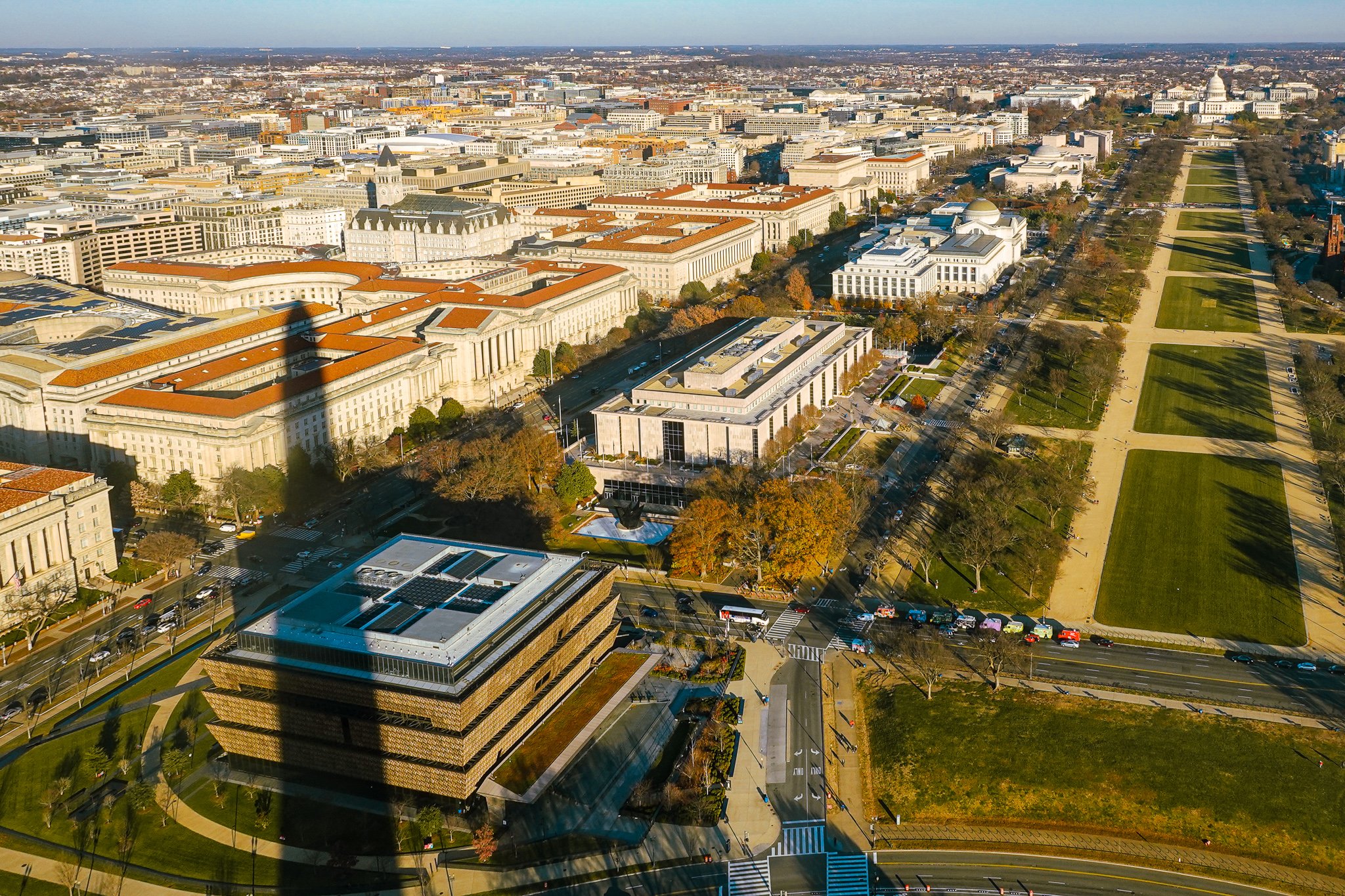
Ever since I first visited the Washington, DC in elementary school, the Washington Monument came to indicate the end of long trip. Riding in a school bus from Richmond, the monument was the first sign of DC as we passed through Pentagon City, Crystal City, and the Virginia suburbs. It’s the first part of DC we could actually see from afar. Then came the Jefferson Memorial, Capitol Building, Lincoln Memorial, and the rest of downtown.

Looking up to the monument is something one can do from almost anywhere in the DC area.

Looking down from it is another story. I recently visited the top of the monument and wanted to share a few photos! But, the fact that I was actually able to ride the elevator up to the top was somewhat a feat in and of itself.

When an 5.8 magnitude earthquake centered 85 miles from DC hit in 2011, the Washington Monument was one of the buildings damaged to the extent that it needed to close to visitors immediately. The repairs, mostly to stones near the top of the memorial, took nearly two and a half years. After reopening in 2014, the lone elevator that takes visitors up and down the 555 tall obelisk failed more than two dozen times over the course of the next two years. Starting in 2016 the monument has been closed intermittently for various reasons, including the pandemic. Here’s a very brief timeline:

August 28, 2011: Closed due to damage from the earthquake
May 12, 2014: Opened to great fanfare after all earthquake repairs are complete.
September 26, 2016: Closed after the elevator failed multiple times since 2014.
September 19, 2019: Opened, with a new elevator, electrical, and mechanical systems. The National Parks Service also debuted a small security screening building at the base of the monument.
March 14, 2020: Closed due to public health implications related to the pandemic.
October 1, 2020: Opened with new pandemic mitigation protocols.
December 18-21, 2020: Closed and reopened due to a covid-19 outbreak related to a private tour inside the monument.
January 11, 2021: Closed indefinitely for the upcoming inauguration and the ongoing pandemic.
July 14, 2021: Opened.
August 16, 2021: Closed after a lightening strike caused the electrical systems to malfunction.
August 28, 2021: Opened and remains so to this day.

Did you get all of that?

Since August 28, 2021 the Washington Monument has been open to visitors with timed entry passes. You can secure a ticket on the Recreation.gov website the day before your visit. At this point, there are no same-day tickets available.

Fun fact: When complete, the Monument became the tallest building in the world passing Cologne Cathedral in Germany by 40 feet. That distinction lasted just five years when it was surpassed (at almost twice the height) by the the Eiffel Tower.

For even more photos from the top (40+) and more fun facts about the Monument, check out the Attucks Adams Patreon. And a hearty thanks to all the Patrons who have supported my work over the past year. You are appreciated!

National World War I Memorial: First Look

IMG_3353.jpg

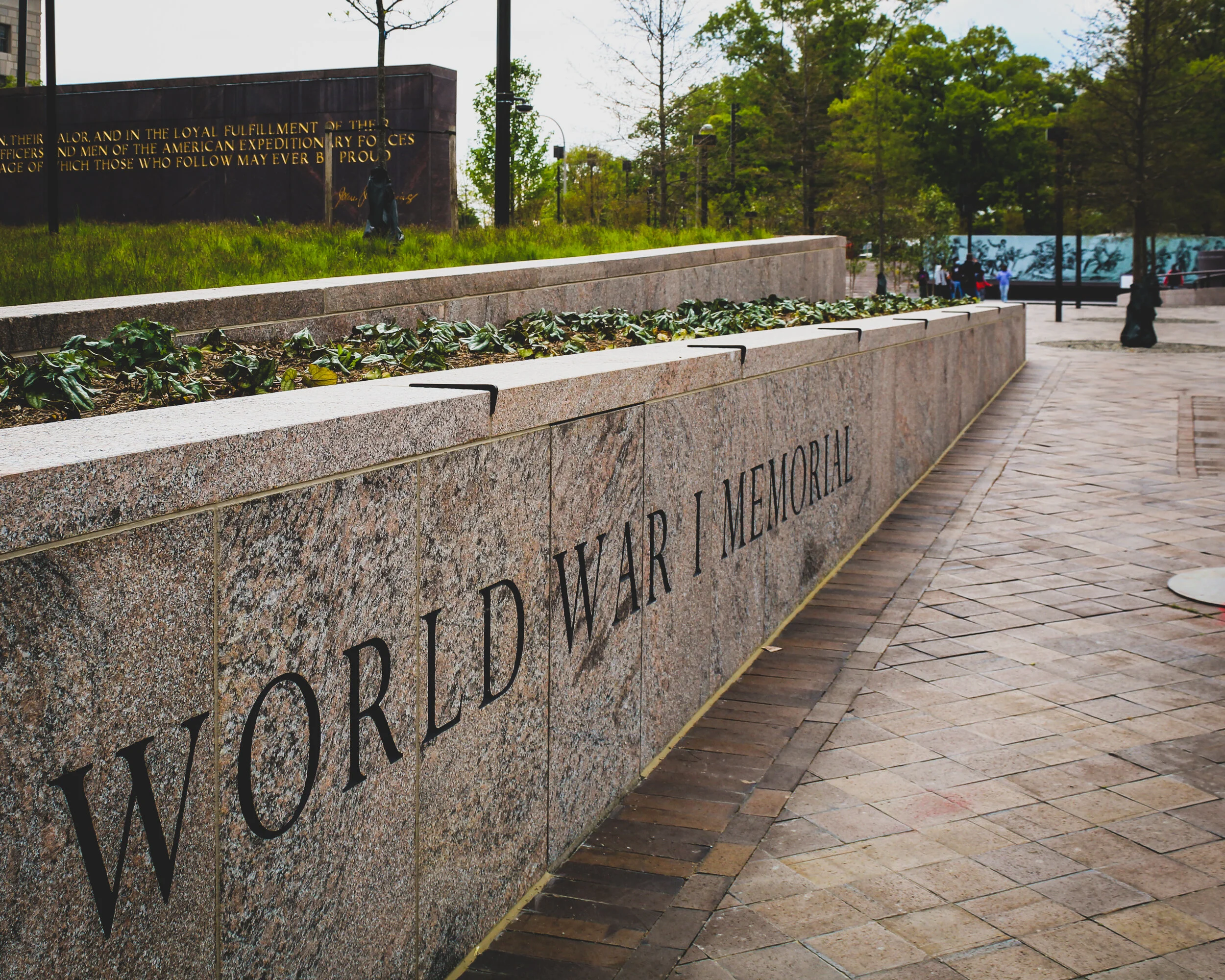
One hundred four years after the United States Congress declared war on Germany and entered World War I, the first national World War I Memorial was dedicated in Washington, DC. Known as The Great War or The War to End All Wars, what began as a Europe-centric conflict quickly spread to include sovereign and colonized nations worldwide in Asia, Africa, the Middle East, and the Americas.

IMG_4637.jpg
IMG_4640.jpg

After resisting entering the war during his first term as President, Woodrow Wilson eventually asked Congress to declare war against Germany in April 1917, which they did. The war, which began July 1914, ended 19 months later, on November 11, 1918.

4,734,991 U.S. Americans served during World War I. With 116,516 total deaths, it remains one of the deadliest conflicts in United Stated history, leaving only World War II and the Civil War with more total deaths during a single conflict. The new memorial has been years in the making and is unique among war memorials in DC.

See the full 24 photo set on our Attucks Adams Patreon page. That’s also where you will find additional posts featuring interpretation, historical context, and my final observations about this newest addition to the memorial landscape of Washington, DC. A huge thanks to all Patrons for making this work possible!

IMG_3365.jpg
IMG_4618.jpg
IMG_3362.jpg
IMG_3369.jpg